The Via Francigena from Ivrea to Pavia
Experience the Via Francigena as it descends into the Po Valley: a week-long pilgrimage from Ivrea to Pavia through rice fields and along the Ticino River

In this article
Table of Contents
- Start: Ivrea
- Distance: 140 km
- Difficulty: Moderate hiking
- Stages: 7
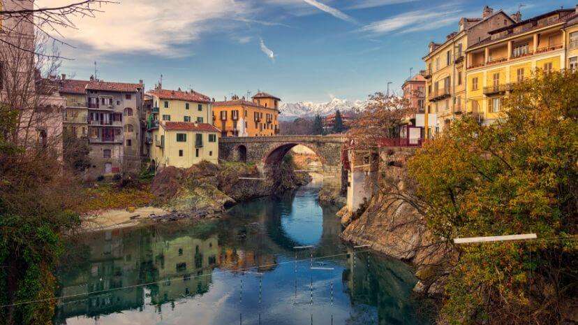
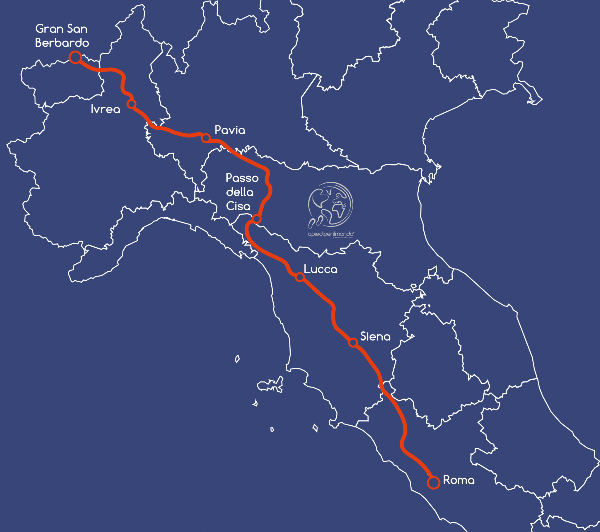
After completing the initial mountain section of the Via Francigena from the Great St. Bernard Pass to Ivrea, the pilgrimage continues across the Po Valley plains, from Ivrea to Pavia.
Stretching approximately 140 km, it takes 7 stages to complete the entire route. The challenging elevation gains become a distant memory.
The path first runs alongside La Serra, a moraine formation that forms the backdrop to Ivrea, then descends among the rice paddies of the Vercelli and Pavia regions until reaching the Ticino river, which guides pilgrims to Pavia.
During this week of walking, you'll find similarities with the more famous meseta on the Camino de Santiago. After becoming accustomed to mountains, stepping into a landscape with an unobstructed horizon has a striking effect for the first few days.
After the initial two days, leaving the Ivrea province behind, the scenery becomes completely flat. Around you are cultivated fields and rice paddies, which create the illusion for walkers that they're making no progress and remaining in the same spot.
Perhaps this is the most mentally challenging section of the Via Francigena to walk, not from a physical perspective, but mentally. The small villages you pass through preserve memories of post-war rural Italy, with churches always at the centre and narrow lanes radiating outward until they become unpaved tracks disappearing into the fields.
The route is mostly on footpaths, though asphalt begins to appear.
Want to start from Pavia? Read our article on the Via Francigena from Pavia to Cisa Pass.
Challenges Along the Route
As already mentioned, the Via Francigena from Ivrea to Pavia presents no particular physical difficulties, since most of the route is completely flat.
The challenge, perhaps, is for those walking this section in complete solitude, because when the landscape doesn't change, you constantly have the impression that you're not making progress and are instead remaining in the same spot.
The scarcity of villages only intensifies this sensation. Another thing to keep in mind is, during summer days, the almost complete absence of shaded areas, making a hat more than essential.
Another minor drawback, always during summer, is mosquitoes: the water-rich rice paddies and irrigation channels favour the development of these insects, but don't worry—a good repellent will solve the problem.
Where to Sleep
From Ivrea onwards, you can always rely on pilgrim hostels run by local parishes.
Since this isn't a high-tourism area, hotels and B&Bs are significantly fewer, but if you prefer not to choose hostels, you can always opt for farm stays (agriturismos) in the area, though they may be slightly off the main route.
What to Eat
All the villages along the Via Francigena from Ivrea to Pavia have bars, bakeries, groceries, and supermarkets, so there's no need to stock up the day before.
You'll also find many taverns and trattorie offering good-quality meals at reasonable prices. Surrounded by rice paddies, you can't miss tasting rice prepared in various ways, such as the "panissa" from Vercelli or the "risotto alla certosina," typical of Pavia—high-calorie dishes but useful for replenishing energy spent during a day's walk.
In the Pavia area, you'll also get closer to a region famous for its cured meats and wines from its hills, such as Barbera or the more renowned Buttafuoco.
Via Francigena Stages from Ivrea to Pavia
Ivrea → Viverone 19.3 km
Viverone → Santhià 15 km
Santhià → Vercelli 27 km
Leaving Ivrea behind, the elevation gains diminish as already mentioned, though they haven't completely disappeared. You walk alongside the Serra, Europe's largest moraine formation, unique in its landscape.
From here, there are several route variations: you can go directly to Santhià, but the route involves more asphalted secondary roads. Those who prefer footpaths can comfortably follow the original Via Francigena and stop at Viverone, where there's a magnificent view over the lake of the same name.
From Santhià begins the true plains. The trail unfolds on unpaved roads between cultivated fields and farmhouses, passing through small agricultural villages, and as you approach Vercelli, rice paddies with their typical landscape: water mirrors in spring and golden hues in autumn and winter.
Vercelli → Robbio 18.5 km
Robbio → Mortara 14.3 km
Mortara → Garlasco 20.7 km
Garlasco → Pavia 25.5 km
From Vercelli onwards, the Po Valley reveals its truest, greenest character. The rice-growing countryside dominates, long stretches of unpaved paths alongside irrigation channels lead pilgrims to lose themselves, and the endless horizon leaves space for thoughts without providing any point of reference.
On fine spring days, however, you only need to turn around to glimpse the Alpine massifs in the distance, above all Monte Rosa, mirrored in the flooded fields. During these stages, you also cross regional boundaries, leaving Piedmont behind to enter Lombardy, the third region on this pilgrimage to Rome.
In the final kilometres between Garlasco and Pavia, the unpaved roads give way to grassed tracks where signposts sometimes hide; trees are rare and therefore shaded areas scarce. In summer, it's always better to start early to avoid walking during the hottest hours.
As you approach the provincial capital, the route winds along the Ticino river embankments, leaving intensive agriculture behind. The stage ends with a view of the covered bridge over the river, the gateway to
Share
apiediperilmondo by wayure
New articles on walks, trekking and hiking trips. Free, no spam.
Redazione
La redazione di Apiediperilmondo. Guide, itinerari e storie nate camminando: consigli pratici, cammini in Italia e nel mondo, letture e spunti per chi viaggia a piedi.
Profilo e tutti gli articoli di ApiediperilmondoDiscover our itineraries
in Italy.
Via degli Dei in 5 stages
Via Francigena from Lucca to Siena
Via del Sale from Varzi to Portofino
Want a tailor-made itinerary?
Plan your trip