Top 5 Iceland Treks: Walking Earth's Last Wilderness
Discover Iceland's most breathtaking treks on foot. From volcanic landscapes to glacial valleys, explore five unforgettable routes through one of Earth's most pristine and dramatic wilderness regions.

In this article
Table of Contents
Breathtaking glaciers and waterfalls, thermal springs like geysers and bubbling hot lakes, active volcanoes, vast expanses of lava fields and snow-capped mountains – Iceland presents itself in nothing short of majestic fashion!
The challenging climate – located at the edge of the Arctic Circle, southeast of Greenland – has not prevented this country from becoming one of the most coveted destinations among travellers.
The "Land of Ice and Fire" boasts over 4,500 square miles of glacier, and its English name, Iceland, perfectly captures what awaits us. Beyond that, this land exists because of volcanic eruptions, still featuring numerous active volcanoes today.
Moreover, as I mentioned at the start, it's a land rich in hydrothermal springs! Who wouldn't appreciate immersing themselves in warm, sulphur and silica-rich springs at around 40°C?! These natural pools often offer stunning views across expanses of snow-covered volcanic rock.
Surrounded by ocean, this island is also a perfect place to observe whales, dolphins and porpoises – ideal for those who love marine wildlife.
For travellers unwilling to forgo urban charm during their holiday, it's possible to make a stop at the capital, Reykjavik, where I recommend sampling Icelandic fish specialities and visiting the Parliament building constructed from dolerite, where stands a statue of Jon Sigurdsson, hero of the long struggle for independence from Denmark.
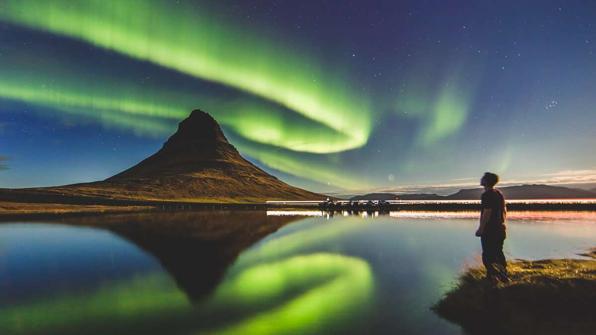
Completing the picture of opportunities Iceland offers, this is perhaps the finest place to witness the Northern Lights, especially from September through April.
We're here, however, to showcase the diverse trekking opportunities on the island, so let's explore the 5 best treks in Iceland.
Laugavegur Trek: The Trail of Hot Springs
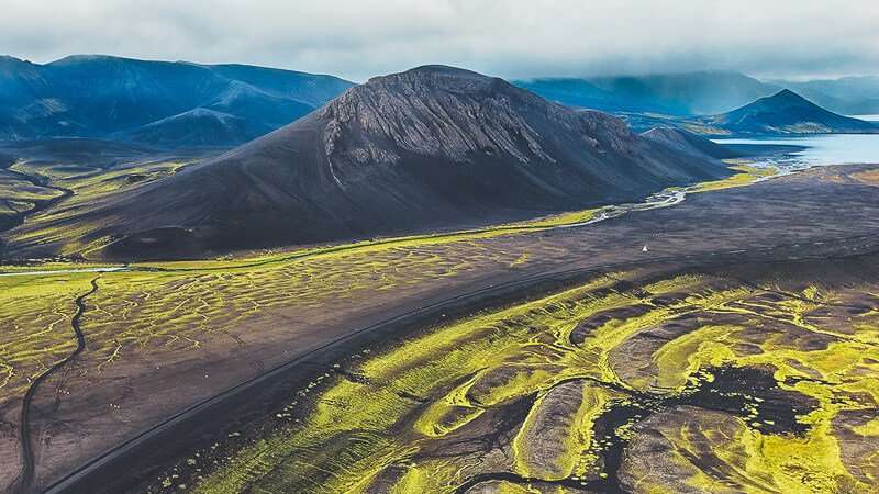
The world's most spectacular trekking experience? It happens in Iceland, yet remains unknown to many, even seasoned hikers. Lonely Planet's "Epic Hikes of the World" – a wonderful guide compiled from responses by over 200 authors on their favourite hikes – places Laugavegur at the top. We couldn't possibly exclude it from our list of the 5 best treks in Iceland.
Against a still-pristine landscape, amid desert zones and deep canyons, in the heart of nature's eternal struggle between glaciers and volcanoes, unfolds the Laugavegur trek, "The Trail of Hot Springs".
With an average duration of 4-5 days, covering approximately 55 km and daily elevation gains of up to 500 metres, it can be completed in any season, though June to August remains optimal. That said, every Icelandic season is special – sudden weather shifts, rain, snow and powerful wind gusts are ready to spice even the summer days.
The trail is not particularly challenging from a hiking perspective. Located in the south-western region, it offers five fairly basic refuges for sustenance and rest (though spaces are limited and advance booking is essential) nestled within Icelandic wilderness. It begins in Laugavegur, a mountainous region near the Hekla volcano, abundant with hot springs and featuring colourful peaks and lava expanses. The finish is the glacial valley of Þórsmörk, between the Tindfjallajökull and Eyjafjallajökull glaciers.
The first stage takes 3 hours, connecting Landmannalaugar to Hrafntinnusker; the second stage, 4 hours, goes from Hrafntinnusker to Álftavatn, crossing a basin lined with volcanic rock; the third leads from Álftavatn to Botnar í Emstrum in roughly 3 hours; finally, the last stage of 6 hours – the most demanding – reaches Þórsmörk. Along the way, you traverse extraordinary landscape variety, often walking for long stretches without encountering another soul, surrounded only by silence and natural beauty.
It's during summer that buses operate from Reykjavik to Landmannalaugar, taking about 4 hours. I recommend checking service availability before departure.
Trails in Vatnajökull National Park
Iceland possesses unique landscapes, sculpted by the constant interplay of ice and fire, forever evolving. In the south-east lies Europe's largest glacier by volume: Vatnajökull, a magnificent ice cap occupying 8% of the island's surface area (8,100 km²), situated within the spectacular Vatnajökull National Park, established in 2008, along with two other national parks: Skaftafell and Jökulsárgljúfur.
The landscape here is genuinely vast and varied – valleys, gorges, level stretches extending to the sea. Beneath the glacial blanket lies a collection of still-active volcanoes, including Grímsvötn, whose 1996 eruption melted significant ice, causing a tremendous flood to the valley below, and Bárdarbunga, which awoke between 2014-2015, spewing fire and rock from its magma chamber 12 km beneath the ice cap.
Within Vatnajökull National Park exist trails of varying difficulty: there are "easy paths" – straightforward routes mostly with smooth surfaces, typically without obstacles or significant challenges, suitable for all; then "challenging paths" featuring lengthy, steep sections with streams or rivers to ford, recommended for those already well-trained; and finally, for the most adventurous, "difficult paths" – highly demanding, with steep inclines and rock barriers requiring scrambling. Choose carefully.
This extraordinary Park, a hymn to nature, also includes routes for those with mobility challenges and wheelchairs: corridors wider than 75 cm, equipped with handrails and rest areas with benches every 100 metres, featuring compact gravel surfaces and wooden platforms at scenic viewpoints; slopes remain below 6%, helpful too for any accompanying person.
To reach the Park, take Ring Road 1 – Iceland's main highway – accessible from various locations. From Reykjavik, the distance is roughly 400 km – about 5 hours maximum by car. Best visited between late May and September, though always be mindful of changeable weather and the possibility of shifting from sunny days to rain and fog.
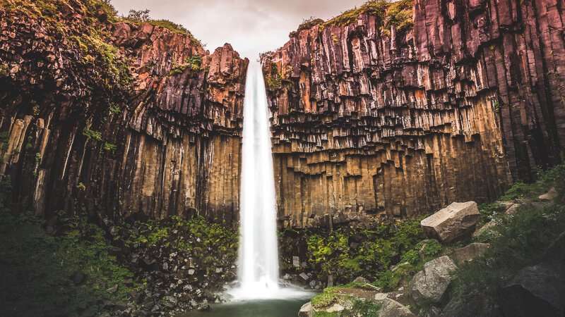
Several trails exist throughout the Park; some are so beautiful and incredible they rank among Iceland's finest treks. Among the most famous is the Svartifoss – Sjónarsnípa – Sel trail: beginning and ending at the Skaftafell visitor centre, this circular walk ascends to a scenic viewpoint above the waterfall (140 m elevation gain over 1.5 km), Sjónarnípa. You'll cross footbridges and steep staircases with sheer drops, but the views are absolutely marvellous. The entire route spans 5.5 km with 2-3 hours walking time.
Within the Skaftafell area, various routes lead to Hvannadalshnjúkur – Iceland's highest peak at 2,169 m (note: it's also a volcano!!!) – and to the famous Svartifoss waterfall, a natural amphitheatre enhanced by distinctively prismatic basalt columns.
Another route lies in the Jökulsárlón area, the glacier lagoon with floating ice; the reference town with a visitor centre is Höfn, where the Hjallanes circuit begins, connecting Skálafell farm to Skálafellsjökull glacier: approximately 8 km over 4 hours walking.
In the Hoffellsfjöll mountain area, you'll find routes reaching Geitafell summit, varying in difficulty from 30 minutes to 5 hours.
In the northern section of Vatnajökull National Park, the Jökulsárgljúfur zone, the source of the Jökulsá á Fjöllum river, near the subglacial volcano Bárdarbunga, has carved a frozen river canyon stretching 25 km, 500 m wide, and in many places 100-120 m deep, featuring numerous breathtaking waterfalls including Selfoss, Dettifoss and Hafragilsfoss.
The Snæfell Wilderness Area takes its name from the 1,833-metre mountain. The level zones to the west comprise the Sandar plains, where large reindeer herds can be spotted, especially in late summer. Alpine vegetation thrives here, including glacier buttercup and alpine hawthorn.
Trail to Dettifoss Waterfall
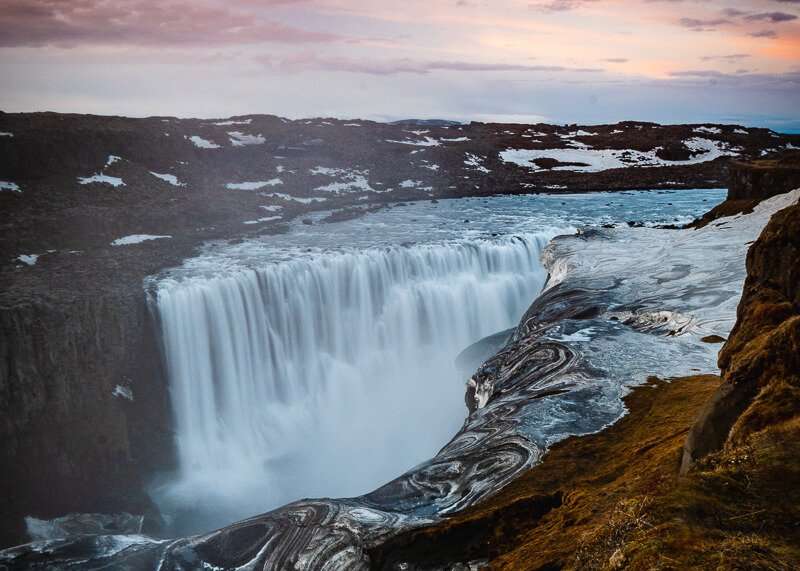
This country is one constant surprise, and among its almost-secret treasures stands Dettifoss, the "waterfall of the rushing water"!
Dettifoss's power is staggering – averaging over 500 cubic metres of water per second in summer, roughly 200 the rest of the year, depending on ice conditions. A spectacular sight because the 45-metre plunge, carrying mud, sediment, ice and water vapour, appears to be bearing down on us, once again demonstrating nature's irrepressible force.
Each year the greyish water, coloured by debris, erodes the stone with its constant flow, pushing the rock face back by half a metre southward. The river responsible is Jökulsá á Fjöllum – the glacial river – stretching 200 km. Born from the Vatnajökull ice cap itself, it flows to the far north into the Arctic Ocean, not before creating a series of waterfalls; alongside the more famous Dettifoss, you'll find Selfoss (20 minutes walk) and Hafragilsfoss (1.5 hours hiking), standing at 10 and 27 metres respectively.
Returning to Dettifoss, it can be viewed from both sides. Typically, access is from
Share
apiediperilmondo by wayure
New articles on walks, trekking and hiking trips. Free, no spam.
Redazione
La redazione di Apiediperilmondo. Guide, itinerari e storie nate camminando: consigli pratici, cammini in Italia e nel mondo, letture e spunti per chi viaggia a piedi.
Profilo e tutti gli articoli di ApiediperilmondoTurn this inspiration into a real journey.
Tell us about your dream walk: we will build the itinerary together.