The 5 Best Treks in Norway for Wild Adventure
Discover the 5 most rewarding treks across Norway's untamed wilderness. Walk through breathtaking mountain landscapes, pristine fjords, and remote valleys that will transform your soul.

In this article
Norway undoubtedly represents an ideal destination in the collective imagination for a perfect holiday: its pristine nature, striking landscape diversity, dramatic fjords, the northern lights, midnight sun and above all the endless opportunities for unforgettable hiking adventures in close contact with a beautifully protected territory.
Norway stands as an example among countries that are light years ahead in the fight against CO2 emissions; eco-sustainability is an ideal rooted in the traditions of this people and positions it unquestionably as a beacon of hope for the future, a model to follow.
Wooden houses and buildings, electric vehicles and incentives for cycling and walking as transport, elimination of coal in favour of almost total renewable energy use, ecological ports, zero deforestation and protection of flora and fauna, cities designed to become completely eco-sustainable… who wouldn't want to visit a country like this!!!
Norway is the ideal country for a holiday focused on nature and physical and mental wellbeing. For these reasons, we'll explore some detailed hiking ideas to help you plan ahead if you're looking for fresh inspiration for your next holiday.
We've selected what we believe are the 5 best treks in Norway, each offering different experiences and appealing to various types of walkers. Enjoy reading!
Hiking to Preikestolen
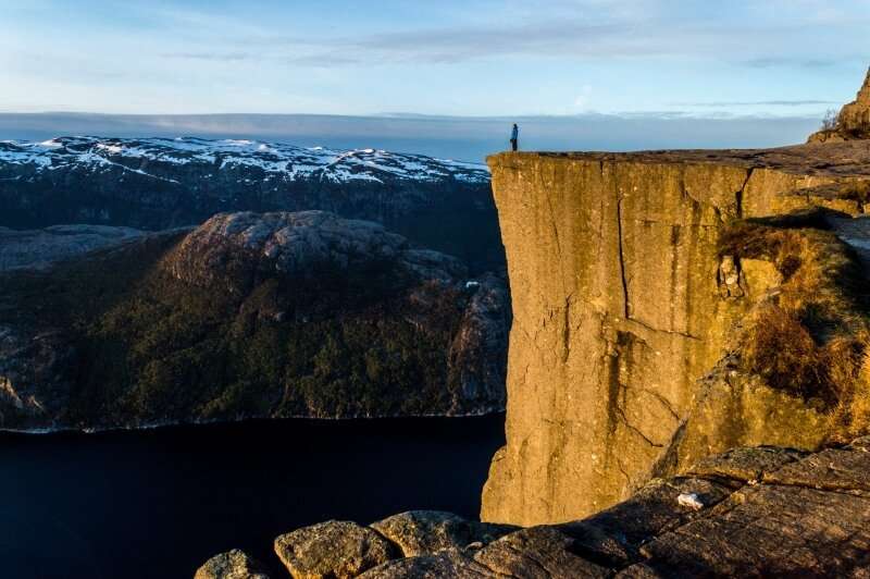
Located in the south of the country, more precisely near the village of Forsand, Preikestolen represents one of the most popular destinations in all of Norway for nature lovers and mountain enthusiasts.
The hike takes approximately 4 hours round trip, covering a total distance of 8 kilometres.
The trail starts from the "Preikestolenfjellstue" lodge, accessible by car or ferry in about an hour from Stavanger, a well-known cruise ship port.
You start at approximately 270 metres elevation and reach a maximum height of 600 metres at the final destination, with some quite steep sections along the way.
Although it appears straightforward due to its short distance, the real challenge of this trail lies primarily in the uneven terrain, so it's best to be in good physical condition with some hiking experience and pay careful attention to each step.
You can reach Preikestolen year-round, but it's strongly discouraged during autumn and winter. The best season is naturally summer, from May to September.
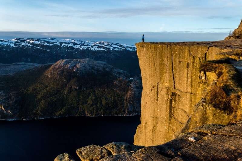
Preikestolen is a pulpit (the name translates as such), a sheer rock formation jutting out over the Lysefjord, where Norwegian authorities decided against installing protective barriers in order to preserve the natural beauty of the landscape.
The St. Olav Way
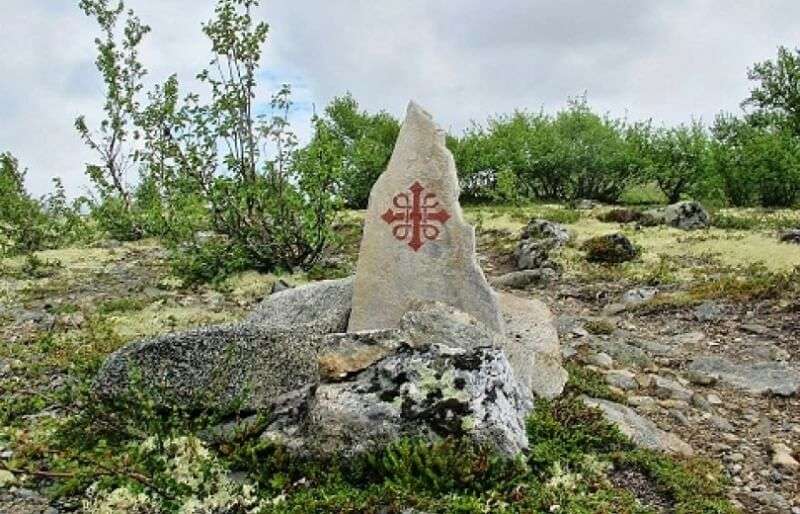
The St. Olav Way is a pilgrimage route that winds across the Scandinavian Peninsula, passing through Norway, Sweden and Denmark to reach Trondheim, a Norwegian coastal city, and has been recognised as a European Cultural Route by the Council of Europe since 2010. This made it essential to include in our ranking of the best treks in Norway.
Olav, patron saint of Norway and known in life as Olav Haraldsson, was King of the Scandinavians. He was born in 995 AD and was killed in battle at Stiklestad, a town near Trondheim, on 29 July 1030. During his lifetime he devoted himself to unifying his entire country into one Christian Kingdom with a democratic structure remarkably advanced for its time – indeed, "St. Olav's Law" forms the foundation of modern Norway's Constitution.
He was canonised shortly after his death, in 1031 AD.
From that moment, pilgrimages began to honour his tomb, and many churches and chapels throughout Northern Europe still bear his name.
The rediscovery of the pilgrimage occurred in the latter part of the last century through important restoration work on these trails, with particular attention paid to signage and path maintenance.
The St. Olav Way is highly demanding, particularly due to terrain characteristics, the need to carry supplies of water and food (as there are long stretches without settlements), and the challenging climate; careful planning is essential, and improvisation is absolutely not advisable, especially from a physical fitness perspective.
Like the Camino de Santiago, this pilgrimage has several different routes to reach the destination: Gudbrandsdalen (The Gudbrandsdalen path), Romboleden (The Rombo pilgrim way), Osterdalsleden (The Osterdalpilgrim way), Nordveien (The Northern pilgrim way). All eventually lead to Trondheim.
The most famous is the first section starting from Oslo (Gudbrandsdalen), the route most heavily used during the medieval period: initially you can choose between the western route passing through Gjovik or the eastern route via Edisvoll, both converging at Hamar. From Hamar onwards there is a single route that passes through major towns including Lillehammer, Otta and Dovre before arriving in Trondheim.
The signage resembles that of Santiago with its famous markers: the starting marker at Oslo shows 643 km to arrival, though GPS traces suggest the actual distance is 40 kilometres more. Signs vary from the classic yellow arrow to the official route symbol made of dark red and white wooden plaques (or stickers) attached along the path.
Like Santiago, the St. Olav Way requires the famous pilgrim credential, which you can obtain from the Pilgrim Office in Oslo. You collect stamps at churches, municipal offices and accommodation; upon completing the journey you receive the pilgrimage Compostela from the Pilgrim Centre in Trondheim.
Hiking to Trolltunga
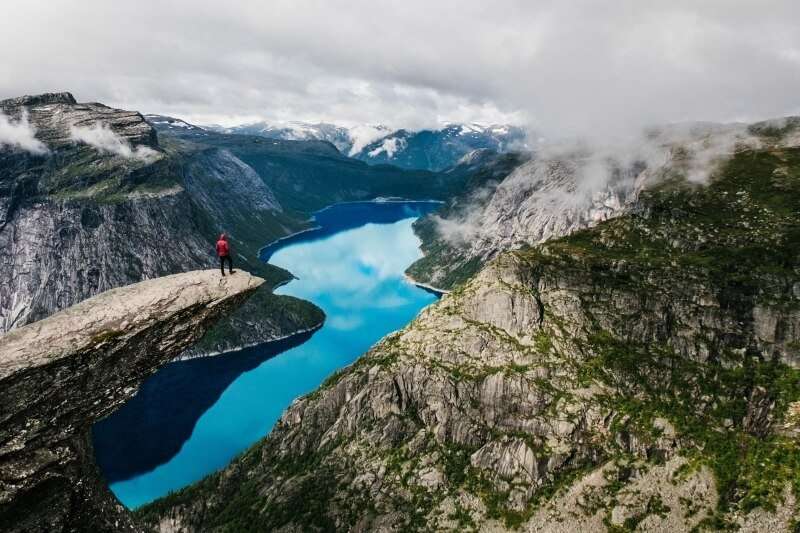
Trolltunga is considered, among Norway's treks, the most beautiful of all! It's a spectacular rock formation shaped like a troll's tongue (translation from Norwegian), jutting out from a cliff of approximately 700 metres with views over Lake Ringedal.
The route covers 27 kilometres with a maximum elevation gain of 1,100 metres and requires 9-12 hours, including rest stops. The initial section will truly test your fitness level, as the first kilometre features stone steps; this hike has a 'black' difficulty rating, meaning it's very challenging and demanding.
You start from Skjeggedal, a mountain village not far from the town of Odda, which many consider the main hub for trekking in that region of Norway; from Odda you take a bus towards Tyssedal and from there you can continue on foot or by a second bus directly to Skjeggedal, where your trek to Trolltunga begins.
You face a steep climb of at least 2-3 kilometres, requiring a good level of physical fitness.
Follow the trail marked with red T signs throughout the entire route, along with signs indicating how far you've come and how far remains. After a second, more relaxed and less demanding section, the challenging climbing resumes from the middle section almost until the end of the walk.
To assist struggling hikers, there are two safety cabins, small emergency shelters positioned along the route, but they're only for emergencies (such as sudden storms or unexpected snow), not for overnight stays. From the second cabin to Trolltunga, the path continues for another 6 kilometres to reach your destination.
The recommendation is to dedicate at least two days to this trek and fully savour the incredible panoramas that unfold along the way: sheer and jagged rocks, deep blue glacial lakes interspersed with emerald forests stretching endlessly, rivers and streams painted like brushstrokes across the fjords. Here nature reveals its purest essence.
Carry a 30-litre backpack to hold everything you might need in the mountains: a map and compass, a first-aid kit, a fully charged mobile phone and a headlamp, suitable footwear, and warm clothes and accessories (waterproof and windproof).
Always bring enough food and drinks when setting out on a hike. It's important to have sufficient supplies so your energy reserves last the entire journey.
If you lack experience or don't feel confident hiking alone, we recommend joining a guided excursion. A good guide can turn even a difficult day into a fantastic experience.
Even if good weather is forecast, conditions can change rapidly. Always check the weather forecast before starting your hike and ask locals what conditions to expect. For this trek too, warmer seasons are recommended.
Hiking to Kjerag
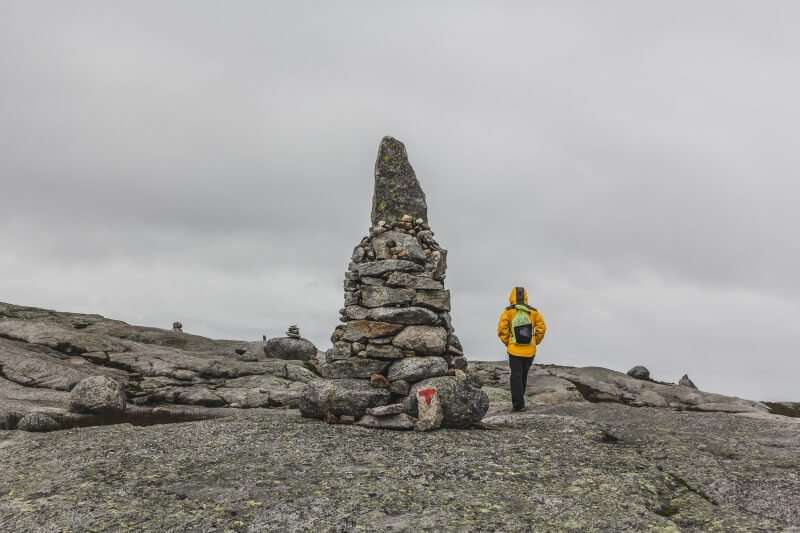
The fourth trek in Norway we want to tell you about is at Kjerag, the highest mountain overlooking the Lysefjord, the same area as Preikestolen, favoured by rock climbers and base jumpers alike. This fjord is also known for the world's highest wooden staircase with 4,444 steps.
The view from up here, around 1,110 metres, is certainly unforgettable, with the opportunity to admire the famous Kjeragbolten, a boulder wedged in a crevasse, and all the lush surrounding nature.
It takes six to ten hours to complete the route, covering approximately 11 kilometres including the return, with an elevation gain of 700 metres.
In some sections you'll need to climb or descend using metal cables (via ferrata sections), so this is a demanding route even for experienced hikers.
You need to reach the town of Lysebotn, from where a very narrow and steep road leads to the Øygardstøl mountain lodge. From there begins the actual trail that will take you to your destination.
Exercise particular caution in wet conditions as the trail can be very slippery; additionally, strong winds present a significant hazard in certain situations.
Regular transport to Lysebotn is available either by ferry (quite expensive and touristy) or by car via the town of Sirdalen, allowing you to enjoy a spectacular scenic drive. In summer, which remains the recommended season, there's a shuttle bus service from Stavanger to Kjerag/Øygardsstøl with early morning departures and afternoon returns specifically designed to allow travellers to enjoy this excursion.
Trekking on the Lofoten Islands
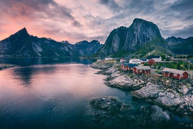
Just a few kilometres north of the Arctic Circle, the sea is populated with "mirages of floating mountains inverted in front and behind you, while whales play and birds cry out", as poet Bjørnstjerne Bjørnson described the Lofoten Islands.
If you decide to visit Norway to discover its treasures, you must certainly consider a trek on these islands. The red fishermen's cottages hugging the shoreline amid enchanting scenery such as the extraordinary spectacle of the midnight sun in summer and the northern lights from September through March.
Geologically, this archipelago is formed of rocks dating back approximately three billion years, among the oldest on the planet, sculpted by mountains that emerged from glacial ice.
The islands comprise 7 islands with 25,000 inhabitants, featuring alpine landscapes right at sea level with emerald-green waters rich in cod and herring, the main livelihood for islanders, surrounded by scattered lakes dotting the entire area.
Despite what the latitude suggests, the climate is milder than in other locations at the same altitude, thanks to the Gulf Stream which allows temperatures to reach twenty degrees during summer and prevents freezing Arctic conditions in winter. Despite this, it's worth noting the weather's tendency to change dramatically within the same day.
On the Lofoten Islands, where the echo of the immortal Viking heritage still resonates, you'll find the highest concentration of white-tailed eagles in all of Norway.
At Hurtigruten you can stay in characteristic red wooden fishermen's cottages, the classic robu, moving along the single road that crosses all seven islands and passing through, among other places, a charming village called Å.
Camping is permitted, provided you respect the "access right rules", meaning anyone can freely access and stay in the so-called "unfenced land", or uncultivated areas even if privately owned, but must absolutely leave everything as they found it. What a wonderful sense of respect for nature and shared values!
The Lofoten Islands are meant to be discovered step by step and are best appreciated on foot, as the trekking trails are wonderfully varied. Here everyone, when the snow retreats and nature returns lush and green, begins to venture out to reclaim the beauty of this place with its wild and ancestral character.
The options are numerous and vary in difficulty level. However, due to various steep and quite slippery sections requiring full equipment, it's always advisable to be well-trained as the walking hours are substantial.
Among the most scenic destinations on the Lofoten Islands is the route from Svolvaer heading towards Mount Tuva, following a steep trail surrounded by blueberries and lakes, continuing to Mount Blatinden at 621 metres, reachable in 7 hours of hiking without excessive difficulty.
On the island of Moskenes
Share
apiediperilmondo by wayure
New articles on walks, trekking and hiking trips. Free, no spam.
Redazione
La redazione di Apiediperilmondo. Guide, itinerari e storie nate camminando: consigli pratici, cammini in Italia e nel mondo, letture e spunti per chi viaggia a piedi.
Profilo e tutti gli articoli di Apiediperilmondo