Germany's 5 Best Trekking Routes for Walking Pilgrims
Discover Germany's most enchanting trekking trails, where medieval castles crown verdant valleys and clouds drift through mountain passes. Let these stunning landscapes awaken your wanderer's spirit.

In this article
Embark on a trekking adventure in Germany, among castles, verdant hills and seas of clouds, let yourself be enchanted by its landscapes, let yourself be surprised by its beauty
Germany is a magnificent place to hike and walk through breathtaking landscapes to discover culture, art and food. The Germans, as we know, are a nation of passionate walkers. They trek in every corner of the world, always with a special fondness for Italy. They know how to travel well, they know how to map out trails and are always the first to write hiking guides and maps.
Despite all this, Germany is not yet a coveted destination among Italian hikers. Perhaps it's the climate, perhaps the language (German is not an easy language, though nowadays everyone speaks perfect English), or perhaps cultural distance – Italian trekkers struggle to approach German trails and plan a walking trip through those lands.
With this article on the 5 best treks in Germany, I want to show you that Germany can be an excellent destination for your active and hiking holidays. The Germans always show consideration for hikers, because they themselves, first and foremost, love this way of travelling and discovering the world.
Germany offers magnificent places to walk, true natural beauties. I actually struggled to select just 5 treks, because the number of trails, and especially interesting ones, is truly vast. Beyond offering quality, with this selection I also wanted to provide geographical variety: as you can see from the general map, the 5 routes are scattered throughout the country – Westweg and Albsteig Trail in the south, the Painters' Way in the east, the Hermannshöhen in the west and the Baltic Coast Trail in the north.
So here are the 5 best treks in Germany, according to A piedi per il mondo of course. I hope they will be an unexpected discovery for you.
Westweg
Nearly 300km of walking through the heart of the Black Forest
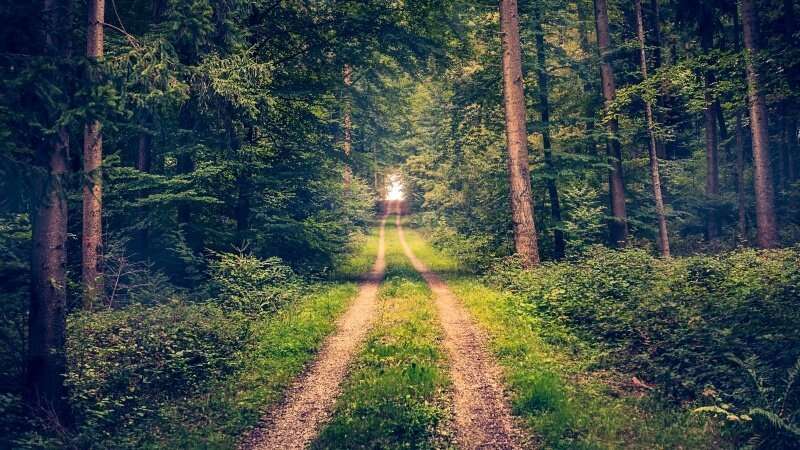
The Westweg trail is a hiking route 285km long that runs, from north to south, through one of Germany's most enchanting and fascinating regions, the Black Forest. It starts from Pforzheim, a major town with a Roman past in the Baden-Württemberg region, and reaches the beautiful city of Basel, just a handful of kilometres beyond the German border, in Swiss territory.
The trek unfolds in the south-western corner of Germany, running parallel and 40km away from the course of the Rhine river and thus from the French border. The Black Forest therefore acts as a watershed between the Rhine (to the west), with its streams flowing towards the North Sea, and the Danube (to the east), which flows towards the Black Sea. It also marks the source of the Danube river, formed by the confluence of the Brigach and Breg streams near the city of Donaueschingen.
A great stone arch marks the beginning of the Westweg trail, considered by many to be one of Germany's best treks. In 1900 it was even designated as the "first long-distance hiking route" by the Black Forest Association.
To complete the 285km of Westweg, you'll need approximately 12-13 days of walking. The elevation gains are not excessive, although the trek is a constant series of ups and downs. The highest point is at 1,493 metres at Feldberg, while the lowest is at 238m at the small town of Hausach.
The route runs for most of its kilometres along the ridgelines of the Black Forest, from which you can admire the wide valleys of Enztal, Murgtal and Kinzigtal. You walk on gravel roads, mountain trails or through forest, with very little asphalt. The Titisee lake is magnificent – we find it a few days before the end of our trek in Germany: here you can choose either the western or eastern variant of the lake, both equally beautiful and long.
The landscapes are truly incredible! You can walk for kilometres completely immersed in nature, and then benefit from the conveniences and services of small towns and villages along the route. Lakes, forests, valleys, but also ruined castles and traditional architecture – the Westweg is all this and much, much more!
The waymarking is constant and well-positioned. The Westweg trail, in particular, is marked with a red diamond symbol, like a horizontally flattened lozenge: you'll find it on trees, rocks, wooden and metal posts – it's practically impossible to get lost. Of course, I always recommend carrying a map of the route, so you always know where you are in case of problems or unexpected situations.
Accommodation is available along the route, though in some cases you may need to detour a couple of kilometres. Since these are hotels, B&Bs and generally private facilities, it's definitely advisable to book in advance. If they're far from the Westweg, you could ask if they offer shuttle service to and from the trail.
Alternatively, you can camp in the many areas specifically dedicated for this purpose. This could also be a wonderful experience and opportunity to fully enjoy this trek through the Black Forest. Of course, you'll need to carry a heavier backpack, but it will certainly be worth it.
Here you'll find the description of each stage, with map and accommodation. Unfortunately it's in German, but it's still useful for getting a general idea of the route.
Albsteig Trail – Trekking through the Swabian Alps, among fairy-tale castles and enchanting landscapes
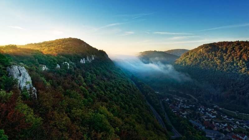
The Albsteig Trail, as you'll soon discover, boasts incredible landscape and cultural richness, which is precisely why we've included it in our list of the 5 best treks in Germany. We're not alone in thinking this way: in 2009 it received, from the Deutscher Alpenverein (German Alpine Association), the certificate of "Quality Trek", while in 2012 it earned recognition as "Top trail of Germany".
Let's explore the Albsteig Trail, its full name being Swabian Alb Nordrandweg.
Classified with the code HW1, the Albsteig Trail is 365km long and traces, for its entire length, the entire mountain range of the Swabian Alps (or Swabian Jura), in the Baden-Württemberg region.
It begins at Donauwörth, a small town of just 20,000 inhabitants located in the state of Bavaria on the banks of the Danube river, from which it takes its name (Donau is "Danube" in German). The trek ends in the city of Tuttlingen, a major industrial hub in the area just 30km from Lake Constance.
The highest point of the route is 1,000 metres, while the lowest is 380m. The total elevation gain and loss is +/- 8,000 metres, not much when you consider it must be distributed over all 365km of trekking. The Albsteig Trail is therefore comfortably doable in 15 stages, with a daily average of about 25km.
The number of stages will depend not only on each person's fitness level, but also on whether you want to spend time exploring cultural attractions near the route, such as visiting castles, caves, or perhaps enjoying a day of relaxation at a spa.
The best time to walk the Albsteig Trail is from March to October, months when snow and sub-zero temperatures are rare. Fortunately, precipitation remains below 75mm year-round, so the risk of rain is not high at all.
Along the route, accommodation is mostly hotels and B&Bs: I therefore recommend booking well in advance, especially if you're travelling during high season, and arranging any shuttle transport in case facilities are far from the trail. Camping is also possible here, but it's recommended to do so in areas specifically designated or equipped for this purpose.
Waymarking is excellent, represented by a red triangle arrow bearing the number 1, indicating the HW1 trail.
Along the Albsteig Trail you'll have the chance to see and walk through incredible towns, landscapes and structures. Among the first examples are Kapfenburg castle and the enchanting ruins of Hohen Neuffen castle. From a natural perspective, we'll enjoy a magnificent view of the Randecker Maar, an ancient volcanic crater dating back 17 million years. Also fascinating is the Uracher waterfall, near the town of Bad Urach: a renowned spa town, it could be an opportunity for a relaxing break along the trek; moreover, it would be worth detouring to visit the ruins of Hohenurach, which are very atmospheric.
Magical, fairy-tale-like, exceptional in its majesty, is Lichtenstein castle, masterfully built on a rocky outcrop in 1840. Together with the magnificent Hohenzollern castle, they alone make the entire journey worthwhile.
In short, the Albsteig Trail is a comprehensive trek that will make you fall head over heels in love with this part of Germany.
The Painters' Way – 112 km of nature, beside the Elbe and above a sea of clouds
The Painters' Way, known in German as the Malerweg, is one of Germany's most beautiful and fascinating treks. The main protagonists of this route are undoubtedly the Elbe river and its majestic sandstone mountains. Known in German as the Elbsandsteingebirge, they are rocky walls with bizarre shapes, interspersed with gorges and very lush, dense vegetation.
Their charm has attracted the attention of countless artists over the centuries – painters, in fact – who used these landscapes to create evocative and mysterious backdrops. Romantic painters like Carl Gustav Carus and Ludwig Richter come to mind, though the most famous remains Caspar David Friedrich with his oil painting "Wanderer Above the Sea of Fog": here, a man stands with his back to us on a rocky outcrop, gazing out at a sea of mist that candid and enveloping covers the surrounding nature. It's a captivating sight that perfectly captures what awaits the modern hiker.
But painting wasn't the only art form drawn to these magical places. Hollywood has also used them in some of its great blockbusters, such as "The Chronicles of Narnia", "Cloud Atlas" and "The Grand Budapest Hotel".
We're in Saxony, specifically in the Saxon Switzerland area, in the north-eastern corner of Germany. The Czech Republic is right there, within reach. Not far away (just 20km), the beautiful city of Dresden is an important reference point for organizing your trek logistics.
At just 112km long, the Painters' Way is walkable in 7-8 days. The lowest point is around 100 metres, while the highest reaches 550 metres. Despite not reaching high altitudes, the route accumulates +/- 4,300 metres of elevation gain, making it a challenging trek in places that shouldn't be underestimated: reaching the viewpoint on the Schrammsteine rocks requires climbing iron ladders, and you'll need to do much the same to reach the Affensteine rocks.
The Painters' Way starts from Liebethal; from here it intertwines repeatedly with the great Elbe river, along which it runs for some kilometres, until reaching the small village of Pirna Markt. These are just a handful of kilometres apart, each situated on opposite sides of the river.
Attractions along this trek include the Lichtenhain waterfall, Königstein fortress, the spa town of Bad Schandau and of course the old town of Pirna, which we can admire once we reach the end of this fantastic trek in Germany.
Baltic Coast Trail – 400km of coastline, along the Baltic Sea, following a section of the European Trail E9
Germany can boast dozens of mountain, hill and riverside treks, as well as trails through wild forests, but compared to other European countries like France, England and even Italy, it has fewer coastal routes, though it actually counts over 2,300 km of coast including the islands.
If you're a lover of coastal hiking and want to walk beside the ocean in Germany too, I can recommend this fantastic trek along the Baltic Sea. It follows, in its entirety, a section of the European Trail E9, which runs from Cabo São Vicente in Portugal and should reach (some sections haven't been completed yet) the coasts of Estonia.
Walking along the coast has numerous advantages, especially if you decide to set out during the summer months. Think of the warmth, the summer breeze from the sea, a refreshing dip at day's end, the liveliness of seaside resorts, and the magic and charm of a fierce summer thunderstorm. In short, unless you're seeking solitude and don't mind colder temperatures, my advice is to walk this magnificent trek from April to October, avoiding the winter months, which are very cold and rainy.
At 400km long, this Baltic Coast Trail is within everyone's reach. Walkable in 15 stages, it presents minimal elevation gains that don't require special skill or experience to manage. The lowest point is 112 metres, while the highest is just 550 metres. The only downside is the lack of waymarking: it's therefore important to carry a map and hiking guide so you always know where you are and which direction to go.
The starting city is Travemünde, a seaside resort near Lübeck. From here you proceed east, towards the Polish border, which you skirt at the end of your walk. This Baltic Coast Trail reaches the seaside resort of Ahlbeck, on the island of Usedom. Connected to the mainland by a series of bridges, the island of Usedom is divided between Germany and Poland by a clear line: if you look carefully at the map and draw an imaginary line connecting the island border with the mainland border, you'll notice the two lines are perfectly aligned.
The route passes through large and lush forests of pine and beech. Near the village of Nienhagen lies Gespensterwald, commonly called the "Ghost Forest" for the air of charm and mystery that surrounds it: the tall, smooth beech trunks, just metres from the blue sea, make it a true beauty.
Nearby, the modern and characteristic seaside resorts of Wismar and Warnemünde deserve our full attention: the first attracts with the architecture of its houses, all colourful and distinctive, and those of its churches, in red brick; the second lets us admire the lighthouse, the fishing boats lined up in the harbour, the traditional buildings and the new glass and steel structures. To the list we can easily add seaside resorts and cities like Priwall, Boltenhagen, Rerik, Heiligendamm, Stralsund, just to name a few.
In short, 400km of coastline is really a lot and can give you truly unique emotions and landscapes. This Baltic Coast Trail absolutely deserves to be on this list of the best treks in Germany – try it to believe it!
Hermannshöhen – A journey through history and the lands of ancient Saxon peoples
The Hermannshöhen was the first trek in Germany to obtain the German quality certificate for hiking routes, the "Qualitätsweg Wanderbares Deutschland". Its landscape beauty and cultural-historical value are extraordinary, and it rightfully earned this important recognition.
The Hermannshöhen develops entirely along a ridgeline, between the regions of Lower Saxony and North Rhine-Westphalia. It is formed by the union of two complementary trails, each being the natural continuation of the other:
- Hermanns Trail – Runs from Rheine to Horn-Bad Meinberg;
- Egge Trail – Runs from Horn-Bad Meinberg to Marsberg.
In total we're talking about 226km of trails, easily walkable in 11-13 stages. The elevation gains are not excessive – we're talking about an uphill elevation gain of 3,600 metres and a downhill loss of 3,400 metres, figures that spread over more than 200km of walking don't intimidate any hiker. You also don't reach high altitudes:
Share
apiediperilmondo by wayure
New articles on walks, trekking and hiking trips. Free, no spam.
Co-fondatore di Apiediperilmondo e Wayure | Camminatore, imprenditore, costruttore
A hundred times the Camino de Santiago. Eight times the Kumano Kodo. Dozens of times the coasts of Portugal, then the Via Francigena, Ireland, England, Normandy: every walk you find here I have done on my own two feet, in every season, alone and with private groups and companies. I do not offer a single step I have not walked.
Profilo e tutti gli articoli di Vincenzo