The 5 Best Treks in Ireland
Dream of hiking through rolling emerald hills and wild moorlands? Picture yourself standing atop dramatic clifftops with breathtaking vistas, discovering ancient castles and historic ruins around every corner. Discover the 5 best treks across the Emerald Isle, a journey through nature's most inspiring landscapes.

In this article
Discover the 5 best treks in Ireland, a journey through the wonders of the Emerald Isle.
Ireland is home to countless trails waiting to be explored on foot. If you're already imagining yourself walking through pristine forests and beneath dancing skies reflected in crystal-clear waters nestled among verdant valleys, discovering remarkable historical treasures along the way, then it's time to start planning! What are you waiting for?!
I've selected the 5 most iconic treks in Ireland, trails that truly capture the essence of this emerald-hued land and will leave you utterly enchanted. This is a country that will welcome you with vibrant warmth and unforgettable scenery!
The Burren Way and the Cliffs of Moher
Spanning 114km and walkable in approximately 5 days, the Burren Way traverses a unique ecosystem where Arctic, alpine, and Mediterranean plants thrive in remarkable harmony.
We're in County Clare, along the Wild Atlantic Way, immersed in the fabulous landscapes of the Burren. The cliffs lie 75km from Galway, 270km from Dublin, and 177km from Cork.
Planning an approach towards Burren, the ideal starting point is Liscannor, a charming fishing village overlooking Lahinch Bay.
After an hour and a half of walking, you'll reach Hag's Head, one of the finest vantage points for viewing the Cliffs of Moher from a distinctive perspective. Another 4km brings you to the cliffs themselves—undoubtedly one of Ireland's most magical places. They stretch along the coast, reaching heights of 220 metres. A near-essential stop on any first trip to Ireland!
You can visit the cliffs independently from the Burren Way, starting from the Moher visitor centre where a paved pathway of about 600 metres, suitable for all walkers, allows you to enjoy the panorama via various discovery points positioned along the cliff edge, with short trails extending further. This is the most touristy area and therefore less ideal for serious trekking.
Continuing our trek, we reach Doolin, a little further north—a picturesque village of coloured cottages offering various accommodations and numerous traditional pubs. Along this section, you'll admire the Aran Islands across the sea, where ancient Irish (Gaelic) is still spoken.
Beyond Doolin, you'll encounter Fanore and Ballyvaughan, where country lanes gently guide you towards Galway Bay. Burren is just ten kilometres away.
Walking along cliff edges with the sea far below, witnessing constantly unfolding panoramas, allows your mind to find peace, your legs to rejoice in the exertion, your eyes to fill with endless horizons, and your soul to feel light! You'll experience nature anew: waves against rocks, wind carrying seabirds, and sunlight plunging into the ocean.
This is an undeniably challenging trek with sections lacking protection or railings, allowing you to experience it in complete freedom but requiring appropriate caution.
Well-marked with several steep ascents, it's advisable to complete this trek during favourable weather or be prepared for typical Irish weather conditions.
The Causeway Coast Way and the Giant's Causeway
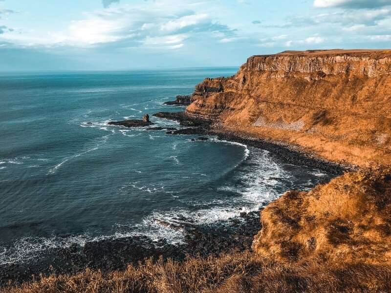
The Causeway Coast Way ranks among Ireland's most breathtaking treks: a 52km coastal walking path stretching between Portstewart and Ballycastle in northeast Northern Ireland, featuring the legendary Giant's Causeway—a UNESCO World Heritage Site of extraordinary natural wonder.
From the golden beaches of Portballintrae, kissed by the cold Atlantic waters and surrounded by low-growing shrubs, the path climbs gently inland along the coast as elevation gradually increases before levelling off. After approximately two hours of trekking, the modern visitor centre at Giant's Causeway comes into view.
From there, you can descend to the famous Causeway via the easier trail, or choose the more challenging, unprotected scenic route offering spectacular panoramas—which certainly enhances the experience but requires careful attention, especially with children. This second option loops back to the first route via a narrow stone staircase carved into the rock, with the Causeway to your left and breathtaking vistas before you!
Finally, you'll walk on the Giant's Causeway itself—a cliff formation composed of 40,000 basalt columns created 60 million years ago from rapidly cooling lava of an ancient volcano. Local legend, far more imaginative, credits the Irish giant Finn McCool with constructing this path to reach Scotland and battle another giant (hence the name Giant's Causeway).
The rocks are so spectacular they seem almost as mythical as the legend itself.
Visit the official site: Causeway Coast Way
The Ulster Way: 900km of Northern Irish Discovery
Ireland, as I've mentioned, is truly an ideal destination for trekkers, with stunning landscapes, enchanting bays, and mountains so vibrantly green they shimmer.
Among the finest trekking options in Ireland is the Ulster Way, a circular route of approximately 900km spanning six counties in Northern Ireland and one in the Republic, where during the luminous summer nights you can spot seals swimming near the coast.
The well-marked path (throughout almost its entire length) allows trekkers to experience the wonders of countless locations and is increasingly popular for long-distance walking. It's flexible, accommodating various stage options or independent shorter walks: short walks under 8km, medium walks between 8 and 32km, or long walks exceeding 32km.
The Ulster Way was designed to connect diverse sections through areas of extraordinary natural beauty and charming towns. Some notable locations include:
- Belfast, home to the Connswater Community Greenway, a flat 8km section;
- Fermanagh, offering fantastic views of Lough Erne and a former quarry transformed into a sensory garden;
- the Mourne Mountains, an hour's drive from Belfast near Newcastle, Northern Ireland's highest mountain range, all granite peaks that in August host the Sperrins Festival, dedicated to hikers and trekkers;
- In County Londonderry, the Banagher Glen trail offers 4km through an area containing Ireland's most ancient oak forests.
Routes are linear or circular with varying difficulty levels; you can also venture through forest-only trails.
Find detailed information on the official Ulster Way website, where you'll discover extensive options including coastal routes, forest and lake trails, and urban trekking through Irish towns steeped in history.
The Wicklow Way: Ireland's Ancient Trail
Stretching 127km and completable in approximately 7 days, the Wicklow Way is Ireland's oldest long-distance walking route—a distinction that naturally places it among our 5 best Irish treks.
It winds through the Wicklow Mountains, 20,000 hectares of peaks on Dublin's doorstep, encompassing a enchanting national park with some of Ireland's most extraordinary landscapes. It's truly ideal for escaping urban bustle and reconnecting with nature.
Autumn is the perfect season, when the mountains display spectacular colours in breathtaking contrast.
The journey to the mountains is relatively short, taking just under an hour. Nearby Aughrim is known as the "Granite Town" for its numerous buildings constructed with stone quarried from the region's mountains. From here, you can follow the famous Wicklow Way or choose a more adventurous route up Croghanmoira Mountain (664m).
The Wicklow Way primarily follows forest roads and country paths with views across surrounding plains. The trail becomes more challenging for those staying at higher elevation, but the effort rewards you with enchanting vistas and unique horizons stretching to the Irish Sea. Both routes lead into Glenmalure Valley.
The Wicklow Mountains' summits are stark and desolate, separated by deep glacial valleys created thousands of years ago, including Glendalough—in Irish, Gleann dá Loch, meaning Valley of Two Lakes, for its two lakes: the Lower Lake and Upper Lake.
This village beautifully blends historical ruins with natural beauty, home to an important monastic settlement founded in 498 AD. You can still see the ancient stone archway that was the monastery's entrance—the only surviving structure of its kind in Ireland—along with numerous carved Celtic crosses and the distinctive Round Tower, a 10th-century structure standing over 30 metres high with a conical roof.
St. Kevin's Kitchen (or Church) remains Glendalough's iconic symbol, considered by experts an authentic masterpiece of medieval architecture.
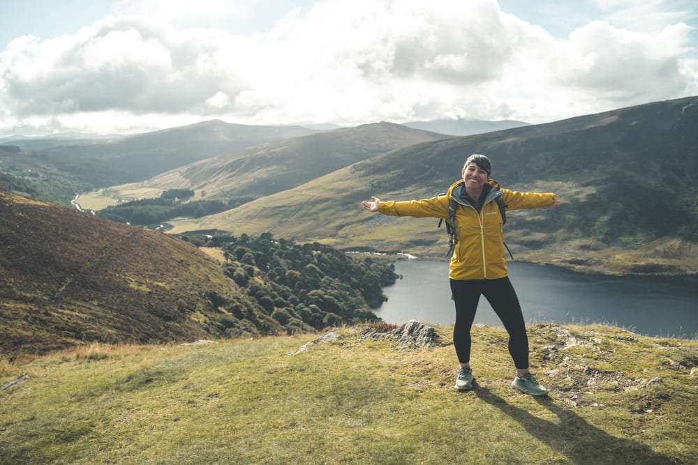
From Glendalough, continue towards Roundwood (Ireland's highest village) via Scarr Mountain and Enniskerry, just outside Dublin. Along the way, you'll pass above Lough Tay—also called Guinness Lake, as it was owned by the Guinness family, or simply because its dark waters flanked by a narrow ribbon of white sand resemble a pint of Ireland's most famous beer.
Read the complete article on the Wicklow Way
The Dingle Way
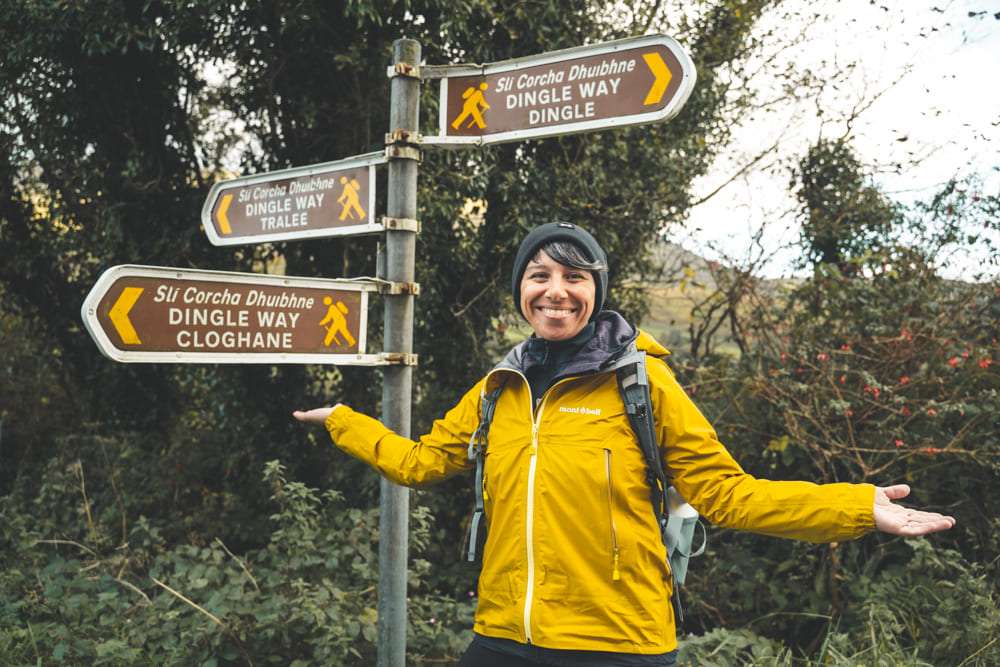
In southwest Ireland, the Dingle Way encircles the Dingle Peninsula with nearly 179km of walking, easily reached by train or bus from Dublin or Cork.
Various trekking options range from one to two days to over a week, with difficulty levels suited to different fitness levels and abilities. The different routes encompass country roads, cliff-edge trails, enchanting coastal scenery, and sweeping panoramic views.
You have two options: complete independence or a guided group tour. Choosing to walk independently, you'll have access to detailed maps and comprehensive guides, with the flexibility to arrange your own accommodation and baggage transport. The group tour option allows you to share the experience with fellow travellers under the guidance of a knowledgeable leader.
Let's opt for a group tour that will help you absorb the spirit of the place while embracing the irresistible joy that a band of fellow walkers creates together.
Starting from Tralee, we undertake a moderate difficulty tour spanning approximately eight stages through small villages, woodlands, rivers, Celtic ruins, and silver-sand bays. It's suitable for all ages and can be completed in a shorter five-day version.
We begin climbing towards the Slieve Mish mountain range before turning west, where the trail becomes somewhat boggy. We continue along the old stone road connecting Tralee and Dingle until reaching Camp.
We traverse a dense forest to the Emlagh River, arriving at Inch Bay; we head towards Annascaul Lake in a glacial valley, reaching the namesake town to complete another day's walking.
We walk along typical Irish country lanes winding through fields and pastures; after crossing the Garfinny River, we head towards
Share
apiediperilmondo by wayure
New articles on walks, trekking and hiking trips. Free, no spam.
Redazione
La redazione di Apiediperilmondo. Guide, itinerari e storie nate camminando: consigli pratici, cammini in Italia e nel mondo, letture e spunti per chi viaggia a piedi.
Profilo e tutti gli articoli di ApiediperilmondoDiscover our itineraries
in Ireland.
Wicklow Way: Short Version with 2 Nights in Dublin
Dingle Way Loop from Tralee
Complete Wicklow Way - Ireland's Oldest Trail
Want a tailor-made itinerary?
Plan your trip