Madrid Way
Walk 320 km from Madrid to Sahagún on Spain's hidden pilgrimage route. The Madrid Way offers an authentic journey through rolling countryside, medieval castles, and authentic Castilian landscapes far from the crowds.

In this article
Table of Contents
The Madrid Way is 320km long and covers the stretch from the Spanish capital to Sahagún, a town positioned exactly halfway along the French Way. From here, another 365 km separate you from Santiago de Compostela, easily reached in a couple of weeks.
Divided into 13 stages but comfortably achievable in fewer days, the Madrid Way is one of the Jacobean routes that is absolutely the easiest. Except for the first stretch to Segovia, the Madrid Way unfolds across virtually non-existent elevation changes, allowing pilgrims to cover greater distances in less time.
In general, the only challenges facing walkers will be the waymarking, often sparse and ambiguous, and the few villages equipped along the way, which will force them to carry their backpacks full of water and food.
A very solitary route walked each year by very few pilgrims, the Madrid Way will test the hiker's resolve, as they navigate lengthy stretches often in complete isolation.
Landscapes
The Madrid Way unfolds almost entirely across flat terrain. Walking on white and earth tracks you find yourself surrounded by pine forests and vast green fields, often cultivated with cereals. And ahead stretches a track that continues straight for kilometres and kilometres, never hidden, but accompanying the walker to the next village.
The beauty of these places lies mainly in the profound solitude and peace that envelops them.
The colours are vibrant and intense, changing with each season. Spring green mingles with red poppies dotting the fields. Summer turns everything golden, darkening in autumn and blanketing in white frost in winter. In short, an explosion of beauty and pure nature.
But the Madrid Way has more to offer. The first stretch sees the path climbing uphill into the mountains as far as Puerto de la Fuenfría. A landscape decidedly different from what you might expect, but one that rewards you with incredible views and gives you the strength to tackle the next 250km.
Elevation Changes Along the Madrid Way
If you've seen photos of the Madrid Way, it's easy to get the impression of a flat route, perhaps gently rolling, set amid green cultivated fields.
In reality, the first stages defy this idea, presenting pilgrims with mountainous landscape and challenging elevation changes.
The most demanding but simultaneously most beautiful climb is the 8 km stretch from Cercedilla to the Puerto de la Fuenfría, in the heart of the Sierra de Guadarrama.
This involves nearly 800m of elevation gain and reaches the highest point of the Madrid Way at 1,818m altitude. Here, the Autonomous Community of Madrid gives way to Castilla y León.
Once you reach Segovia, the Madrid Way becomes, until Sahagún, a flat route, interrupted only by gentle and pleasant ups and downs.
In short, a physically easy trail suitable for everyone.
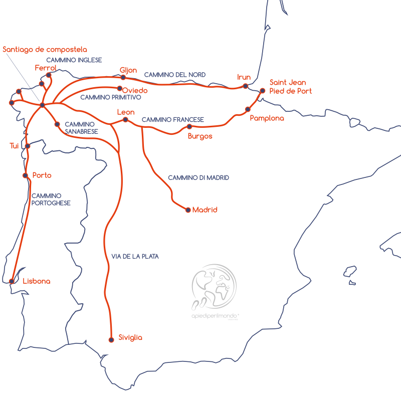
Stages and Albergues Along the Madrid Way
To align overnight stops as closely as possible with available municipal albergues, the Madrid Way has been organised into 13 indicative stages.
- Stage 1: Madrid – Tres Cantos | 25km
- Stage 2: Tres Cantos – Manzanares El Real | 24km
- Stage 3: Manzanares El Real – Cercedilla | 19km
- Stage 4: Cercedilla – Segovia | 29km
- Stage 5: Segovia – Santa María la Real de Nieva | 32.5km
- Stage 6: Santa María la Real de Nieva – Coca | 21km
- Stage 7: Coca – Alcanzarén | 25.5km
- Stage 8: Alcanzarén – Simancas | 31km
- Stage 9: Simancas – Peñaflor de Hornija | 21km
- Stage 10: Peñaflor de Hornija – Medina de Rioseco | 22km
- Stage 11: Medina de Rioseco – Cuenca de Campos | 24km
- Stage 12: Cuenca de Campos – Santervas de Campos | 21km
- Stage 13: Santervas de Campos – Sahagún | 20.5km
Of course, this is merely a suggestion that everyone is free to follow or not.
Apart from three stages of 29, 32 and 31 km respectively, the others average around 20-25km. Given the ease of the trail and the extensive network of albergues and private facilities, pilgrims can easily arrange different stages, extending or shortening them according to their needs.
The albergues for pilgrims along the Madrid Way are almost all municipal, often new and well-maintained. However, dedicated accommodation is lacking in the more important and touristy cities.
Take Madrid for instance, which has no pilgrim-specific lodging except for a few hostels offering discounts to walkers.
The same applies to Manzanares el Real, a town rich in cultural attractions, and Segovia, where it is possible to stay in a municipal albergue in the nearby town of Zamarramala, just a couple of kilometres away.
Where to Eat
Regarding bars, restaurants and refreshment points along the route, it must be admitted that there are not many. Especially from the midpoint onwards, when villages become smaller and more isolated, you risk finding closed or non-existent bars. It is therefore highly advisable to always carry a good supply of food and water, so you can comfortably tackle even lengthy stretches without amenities.
Waymarking and Variants Along the Madrid Way
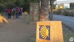
A weak point of the Madrid Way is the waymarking, which doesn't always meet the standard seen on other Spanish trails. The issue isn't the appearance or care of the markers, but their more serious shortage in many sections. Pilgrims sometimes don't know which way to go or aren't sure they've taken the right path. You might not see a yellow arrow for kilometres. True, these are often very long straight stretches with only one road, but pilgrims would benefit from more reassurance to proceed faster and more relaxed.
I therefore recommend paying maximum attention to waymarking, particularly in the second half of the route. In the Autonomous Community of Madrid, the waymarking is indeed significantly better, with abundant stone cairns (mojones) and yellow arrows.
As you progress, the cairns give way to yellow arrows scattered everywhere: on tree bark, on the ground, on signpost outlines, on stones beside the path. So keep your eyes peeled everywhere.
Regarding variants, the general advice is not to follow them except in exceptional cases. The main reason is waymarking problems, which are even more pronounced on variants. Some of the safer variants can be useful.
Where the Madrid Way Begins
Let's be clear: the Madrid Way starts from Madrid.
But exactly from where? Madrid is huge, so which part of the city?
The answer is: everywhere and nowhere. Your pilgrimage to Santiago begins at your own doorstep. Wherever you are in Madrid, that's where your journey begins.
What's certain is that you need to head north. The first yellow arrow appears in Plaza de Castilla, pointing towards the Cuatro Torres business district. Getting past it, you'll reach the Fuencarral neighbourhood and onwards, ever farther from the city, until it becomes a point on your horizon behind you.
Iconic Sites Along the Madrid Way
The Madrid Way is a perfect blend of nature, history and art.
Apart from Madrid, which deserves separate mention, there are several locations along the route that make it a compelling and fascinating pilgrimage.
Manzanares el Real
First, let's say a few words about the Santillana Dam.
Built in 1908, the dam aimed not only to provide drinking water to surrounding towns but to light the valley all the way to Madrid. The project succeeded, and in 1971 the dam was expanded. All previous structures were submerged under 40m of water. Still today, emerging from the lake's surface is the tower of the old dam, constructed in Gothic-Isabelle style to blend with the nearby Mendoza Castle.
A curiosity: Joaquín de Arteaga y Echague, Marquis of Santillana, not only financed the dam's initial project but also committed to funding the restoration of Mendoza Castle, which belonged to his lineage.
The Mendoza Castle, built in 1475 for defensive purposes, stands today in all its splendour at the centre of Manzanares el Real. Some of the stones used for its construction were systematically taken from the old castle of the town, of which
Share
apiediperilmondo by wayure
New articles on walks, trekking and hiking trips. Free, no spam.
Co-fondatrice, Apiediperilmondo
I've been organising walks since I discovered that walking slow is the fastest way to know a place. I take care of every logistical detail so you can focus only on the steps ahead.
Profilo e tutti gli articoli di DeborahDiscover our itineraries
in Camino de Santiago.
Camino de Santiago from Sarria - Last 100 km
Portuguese Way from Tui - Last 100 km

Camino Primitivo from Lugo - Last 100 km
Want a tailor-made itinerary?
Plan your trip